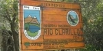
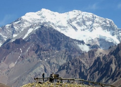
Clarillo River National Reserve. Santiago - CHILE
Direccion:
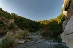
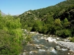
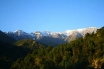
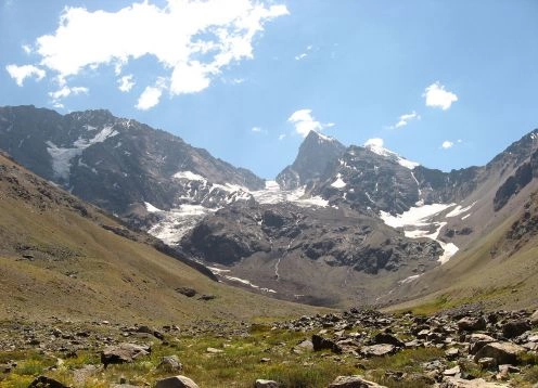
Region Metropolitana, Santiago Clarillo River National Reserve covers an area of 10,185 hectares. >It is located in the foothills, southeast of Santiago in the Cordillera province, commune of Pirque.
Access Routes:
The reserve is located 45 km. Santiago and it is accessed via Route 5 or the way Santiago-Puente Alto-Pirque. Travel time is approximately 1 hour 45 minutes. From downtown Santiago (Plaza Italia), the road is paved the first 32 km. and the 13 km gravel road. remaining from the main to the Reserve.
Management area:
The administrative headquarters are located 300 meters from the access to it.
Ranger office:
It is located in the administrative headquarters of the Reserve
Snack Areas:
The Reserve has several picnic sites distributed in the following sectors:
The Mait?n-La Roca:
? Sector The Mait?n-La Roca 18 sites
? Sector The Peumal 12 sites
? picnic Quillayes 25 sites
? picnic Lingala 14 sites
? picnic Peumo Carlos Diaz
Sector La Tinaja (13 sites):
? Sector Peumo A 9 sites
? Sector B 5 sites Peumo
Rodeo picnic by the Mares:
? Sector North Rodeo 13 sites
? Sector South Rodeo 5 sites
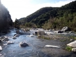
All sites are near each other and spread over an area approximately 4 km. on both banks of the river Clarillo.Each room includes desks, stove, garbage, toilets and laundry. Parking lots are at a roadside remote picnic sites.
Hiking trails:
Interpretive Trail Quebrada Jorquera:
Journey time: 30 to 40 minutes.
Description: Educational Track is located next to the Visitors Center, are 15 stations that describe species of flora and fauna and environments of solam and broken. Degree of difficulty.Suitable for all age groups, with the fragility of natural resources should form groups of 5 to 10 people per tour.
Interpretive Trail Aliven Mahuida:
Length 1.7 km. Journey time: 1 hour 30 minutes.
Description: Educational Track, located in Paso de la Virgen sector consists of 15 stations whose main feature is the biological diversity in environments bush, streams and river, which show great diversity of wildlife: Degree of difficulty.Suitable for all types of people in groups of 10, at most, except in the groups of elderly and / or disabled people.
Other services:
Guided walks, these activities are sporadic and limited enrollment and prior coordination with the administration.
Distances and travel times:
From Santiago: 45 km. - 90 minutes
From Bridge High: 23 km. - 40 minutes
From Pirque: 18 km. - 30 minutes
From The Home: 4 km. - 10 minutes
Services outside the area:
Fuel: Pirque, 18 km.
Telephone: The Principal, 7 km.
First Aid: The Principal to 7 km. Pirque to 18 km.
Sale of Food: The Principal, 7 km.
Police: Pirque, 18 km.