Information about Torres del Paine
TO ACCESS THE TORRES DEL PAINE GUIDE, CLICK HERE
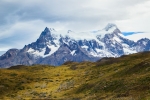
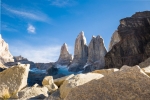
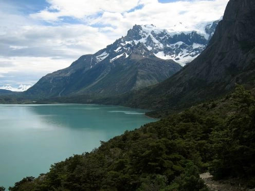
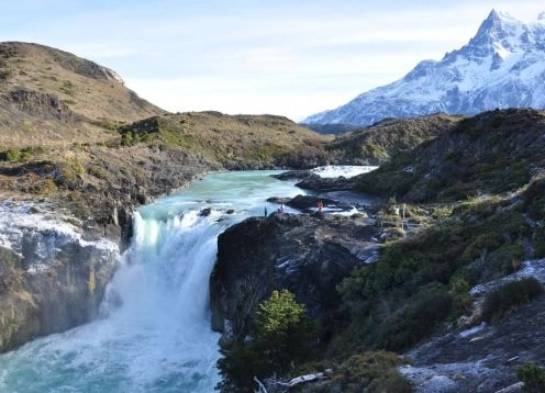
The Torres del Paine National Park has an area of ??181,414 hectares and is located between the Cordillera de Los Andes massif and the Patagonian steppe.
It is located in the province of Ultima Esperanza, municipality of Torres del Paine.
Access Roads
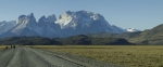
It is accessed at any time of the year by a paved road of 250 km. , which connects Punta Arenas and Puerto Natales and along a gravel road of 150 km. from Puerto Natales. In winter season it is advisable to use chains because of the unstable climatic conditions.
Tourist Information
Area management:
The administrative headquarters is located in the Lake Toro sector, 145 km. from the city of Puerto Natales and 33 from the main access to the Park (Sarmiento porter).
In the building of the Administrative Headquarters, the Visitor Center operates, where Environmental Education activities are carried out. The hours of operation are from 8:30 a.m. to 8:00 p.m.
Park ranger office:
Portería Lago Sarmiento: It is accessed by the main road, is located 114 km. of Puerto Natales and to 36 of Administrative Headquarters. Hours of operation throughout the year from 8.30 am to 8.30 pm.
Laguna Amarga porthole: 102 kilometers along the main road and then a detour to the right in the northeast direction for 13 km. , in total 115 km. , from Puerto Natales and to 38 of the Administrative headquarters. Hours of operation: All year round from 8:30 a.m. to 8:30 p.m.
Laguna Amarga porthole: 102 km. by the main road and then a detour to the right in a northeasterly direction for 13 km. , in total 115 km. from Puerto Natales and 38 from the Administrative headquarters. Hours of service. All year from 8:30 a.m. to 8:30 p.m.
Blue Lagoon Lodge: 102 km. along the main road and then a detour to the right in a north direction for 21 km. , in total 123 km. from Puerto Natales and 58 from the Administrative Headquarters. Hours of service. All year from 8:30 a.m. to 8:30 p.m.
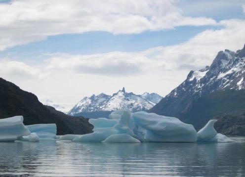
Lake Gray Nursery: Access by the main road 168 km. of Puerto Natales and 18 of the Administrative Headquarters. Hours of operation: All year.
Laguna Verde Nursery: Access by the main road, 85 km. from Puerto Natales, then a detour to the left for 25 km. It does not have access through the interior of the Park.
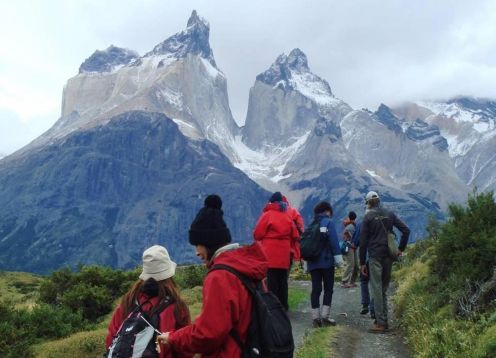
Hiking trails:
Pingo-Zapata circuit:
Type of footpath: Excursion
Administration-Daycare Grey- vehicular road 18 km.
Gray Nursery-refuge Pingo: 1 hour
Zapata-glacier Zapata refuge: 1 hour
Description: The trail starts at the Administrative Headquarters and goes along the vehicular road until arriving at the Gray Lake Nursery (18 km.) Then through low hills until arriving at the Pingo refuge, Zapata refuge, reaching the Zapata glacier.
Paine Circuit:
Type of footpath. Excursion.
Duration: 7 to 10 days of walking.
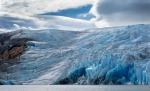
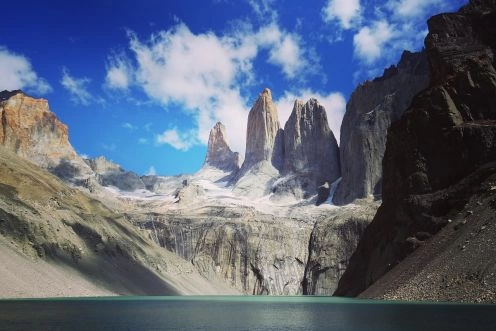
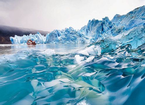
Description of the trail: The trail goes round the Paine Massif, first at mid-mountain and then up to 1,350 meters above sea level, passing rivers, lakes and glaciers such as the Gray, Dickson and Perros.
Dickson Glacier Circuit.
Type of trail: Excursion.
Laguna Amarga-Serón campsite: 5 hours
Campamento Serón-Campamento Coirón: 3 hours
Camp Coiron-refuge Dickson: 3 hours
Description: The trail starts at the Laguna Amarga nursery along a plain until the Serón camp, then continues through small hills through the Coiron camp and again through a plain to the Dickson refuge, from where the glacier can be seen.
The park was created on May 13, 1959. In 1977, Guido Monzino donated 12,000 hectares (30,000 acres) to the Government of Chile and established its final limits. Unesco declared it a biosphere reserve on April 28, 1978.