Queulat National Park. Coyhaique - CHILE
Queulat National Park covers an area of 154,093 ha and is located 35 km. south of La Junta and north of Puerto Swan is located in the provinces of Aysen and Coyhaique, commune of Swan Lake and Green
Access Routes
For the Southern Highway from Chaiten or Coyhaique. The Board (Intermediate People).
A Chaitén air or sea (ferries).
Air Coyhaique land or sea (ferry to Puerto Chacabuco) paved road 75 km. to Coyhaique.
Tourist Information
Management area:
The Park administration is located in the area hanging glacier, km. 20 North Camino Longitudinal Austral.
Camping and picnic areas:
Inside the park Queulat camping is possible in the areas of Angostura and hanging glacier, these same sites can be used for snack. Out of the Park is used for picnic areas.
Outside the park there are areas of particular camp, on the north shore of Lake Risopatrón (cabins on pangue), 25 km. Pendant south of the glacier.
Hiking trails:
Trail Lake Los Pumas:
To be 5,580 m. long, begins in the Angostura area camping, climbing westward through the evergreen forest up to the lagoon the Pumas.
Hanging glacier trail:
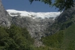
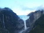
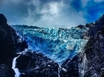
Approximately 3,500 m. begins at the parking area of the camping area, via footbridge over the River Glacier, one climbs up the moraine to reach the viewpoint of the glacier.
River Trail rustic Guillermo:
Get the lagoon icebergs (600 m) after penetrating through the valley toward the river source. Suitable only for experienced hikers.
Source of the River Trail to Waterfall:
It starts at km. 170 of the Camino Longitudinal Austral, rising through the evergreen forest up to the limit on the arboreal vegetation, and allowing access to a lagoon at the foot of a rock wall in an amphitheater in which it is possible to observe icebergs. It has a length of 1,700 m.


