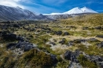
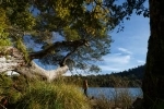
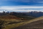
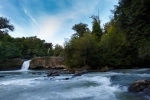
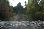
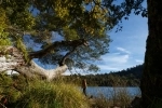
Puyehue National Park. Puyehue - CHILE
Phone: +56 64 1974572
Web:
http://www.conaf.cl/parques/parque-nacional-puyehue/ The Puyehue National Park has an area of 106,772 ha. It is located in the foothills and Cordillera de Los Andes. Its greater extension is located in the province of Osorno, commune of Puyehue, extending by the North to the province of Ranco, in the Region of the Rivers.
How to get to the Puyehue National Park:
The main access to the Park is the International Route 215, which links the cities of Osorno (Chile) Bariloche (Argentina), which is paved to the city of Bariloche.
In the km. 76 of Route 215 is the U-485 variant that goes to the Aguas Calientes sector of the Park, distant 4 km. The road is asphalted in its entirety.
From Aguas Calientes to Antillanca, variant U-485, the road is gravelly, without excessive slopes, but it is still recommended a careful handling for the narrow and winding of the road. The journey is 18 km. , which are covered in 30 minutes
Tourist Information:
Administration of the area:
It is located in the Aguas Calientes sector, 4 km away. of the international route, by the U-485 road that leads to Antillanca.
In Anticura, 22 km. from Aguas Calientes, another ranger office is located. In the offices there are park rangers throughout the year.
Flora and Fauna:
The territory that forms it is characterized by its majestic forests, this evergreen humid forest, is formed by coigües, ulmo, tepa, mañío and coigüe.
Regarding the fauna that lives in Puyehue, it is composed of pumas, foxes chilla, quiques, coipos, güiñas and vizcachas. Among the birds, those that stand out are undoubtedly the condor of the Andes, the choroy, the chucao, the chercán, the bandurria, the traro and the huala.
Excursion Paths:
Aguas Calientes Sector:
Excursion Trail to Lake Bertin:
It has a length of 11 km. , and its duration is 5 hours round trip. The route goes from Aguas Calientes to Lake Bertín, and there is a rustic refuge with capacity for 6 people.
The Pioneer Path:
It has a length of 1,800 m. and a duration of 1 hour and 20 minutes round trip. It leads finally to a viewpoint.
Recreational Path: El Recodo:
It has a length of 380 m. and a duration of 15 minutes, it connects with the Aguas Calientes picnic area.
Rapid Educational Path of Chanleufú:
It has a direct relationship with the natural phenomena of the area, with a length of 1,200 m. and duration of 1 hour.
Anticura Sector:
Excursion trail to Puyehue volcano:
It has a length of 16 km. and the travel time is 2 to 3 days. The trail is self-guided and leads to the Puyehue volcano, the Azufreras and Los Baños. In the foothills of the volcano there is a rustic refuge for 12 people.
Path of Excursion to the Pampa de la Frutilla:
It has a length of 20 km. and the travel time is 2 to 3 days. This trail follows an old path from the last post area.
Recreational Trail The landslides:
It has a length of 580 m. and a duration of 45 minutes.
Recreational Path Salto de la Princesa:
It has a length of 710 m. and a duration of 30 minutes.
Educational Path Salto del Indio:
With 950 m. about 40 minutes long and approximately, it shows interesting aspects of the Evergreen Forest.
Repucura Educational Path:
They have an area of 1,100 m. and one hour long.
