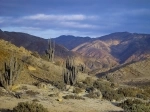
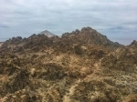
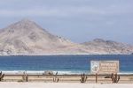
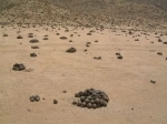
Pan de Azucar National Park. Antofagasta - CHILE
Direccion:
Sector costero de la Region de Antofagasta y Region de Atacama Phone: + 56 52 221 3404
Web:
www.conaf.cl The Pan de Azúcar National Park has a total area of 43,769 hectares, divided into 9,155 in the Antofagasta Region and 34,614 in the Atacama.
Administratively it is located in the Region of Antofagasta, province of Antofagasta, commune of Taltal, and in the Region of Atacama, province of Chañaral, municipality of Chañaral.
Access roads
The Park is accessed through three passable roads throughout the year. One of them is Route C-120 that connects the port of Chañaral and the Administration of the Park, with a length of 29 km. , another is Route 5 - Panamericana Norte at the height of km. 1014, sector Las Bombas, which is accessed by a secondary road, and the third, also by Route 5, is a little more to the south of the previous one, at the height of km. 968
Route C-120 is a ground stabilized and has a layout that was improved, increasing the radii of the curve. The section of route 5, between the sector Las Bombas (km 1014) and the administration of the Park (km 968) is made of dirt and gravel.
Tourist information
Administration of the area:
The administration of the Park is located in Caleta Pan de Azúcar, 29 km. from the Puerto de Chañaral and 10 km. of the entrance to the National Park.
The Environmental Information Center is also located in the sector.
The hours of attention of the Administration sector and the Environmental Information Center are from 8.30 am to 12.30 pm and from 2 pm to 6 pm.
In the Environmental Information Center it is possible to attend talks dictated by park rangers and excursions are scheduled.
Park rangers office:
The park ranger office is also located in the Environmental Information Center (CIA).
