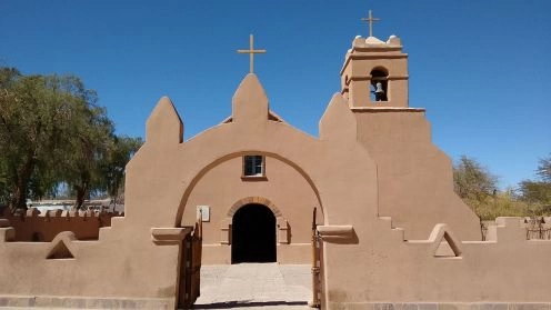
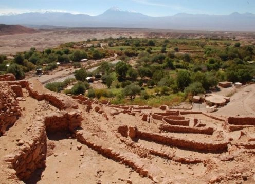
San Pedro de Atacama
You can know Los Flamencos National Reserve in the following excursions
Los Flamencos National Reserve. San Pedro de Atacama - CHILE
Direccion: Region de Antofagasta, comuna de San Pedro de Atacama, provincia del LoaWeb: https://www.conaf.cl/parques/reserva-nacional-los-flamencos/
Los Flamencos National Reserve covers an area of 73,986 hectares and is located administratively in the province of El Loa, commune of San Pedro de Atacama.
It is divided into the following sectors:
Sector 1: Salar de Aguas Calientes Tara
Sector 2: Salar de Pujsa
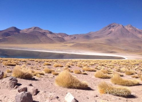
Sector 3: Miscanti and Mi?iques
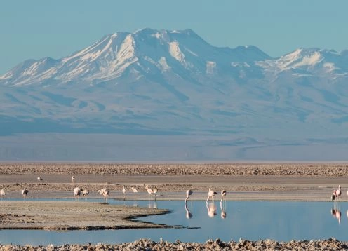
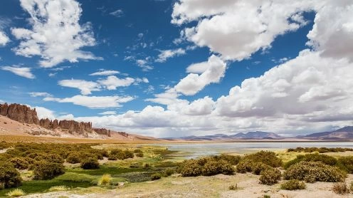
Sector 4: Salar de Atacama
Sector 5: Salar de Atacama (Laguna Water sector Quelana)
Sector 6: Valle de La Luna
Sector 7: Tambillo
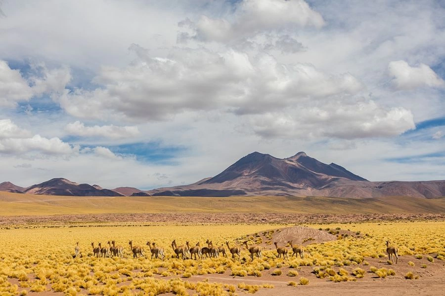
For its size, the unit has significant climatic differences in the various sectors. In the sectors 1,2 and 3 monthly average temperature ranges between 0 ? C and 7 ? C, while the average maximum is located between 3 ? C and 12 ? C and minimum mean between 3 ? C and 5 ? C. In sectors 4, 5, 6 and 7, the annual average is between 9 ? C and 19 ? C, the average minimum between 0 ? C and 16 ? C and maximum average between 10 ? C and 20 ? C.
Rainfall in areas 1,2 and 3 range from 30 to 150 mm. year. In sectors 4,5,6 and 7 between 5 to 25 mm. It is essential to note that the rains are concentrated between the months of December to March and rainfall is frequently associated with thunderstorms.
Sectors Salar de Tara-Aguas Calientes 1:
In this sector are volcanic structures and rolling plains. There erspi?n escarpments east of the Salar de tare and volcanic plumes in the northeast of the Salar de Aguas Calientes 1. The maximum height is 4860 meters above sea level sector.
Salar de Pujsa Sector:
The topography of this area is characterized by rolling plains, a saddle between mountains and volcanic structures, known as Black Hill. The maximum height is 5585 meters above sea level sector.
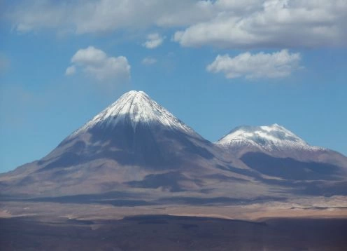
Sector Miscanti and Mi?iques
It is characterized by volcanic and mountainous terrain, highlighting the hills and Mi?iques Miscanti. The sector is alltura maximum of 5,910 meters.
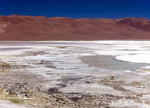
Salar de Atacama Soncor Sector and Quelana
The Salar de Atacama is characterized by its extensive coastline saline, saline their sludge and mud. The terrain is flat with an average altitude of 2,300 meters.
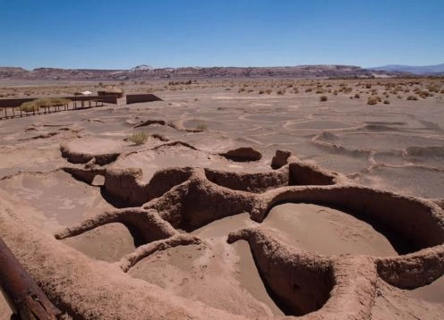
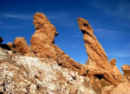
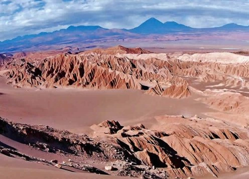
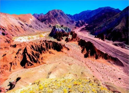
Moon Valley Sector:
Here is the Cordillera de la Sal, its highest elevation is 2624 masl.
Major Sites Scenic Beauty:
Salar de Aguas Calientes Tara 1, especially the northeast of the latter.
The lagoon and Mi?iques Miscanti.
All the Salar de Atacama, in the two sectors (Soncor and Quelana), especially during the afternoon and evening.
The Valley of the Moon, famous and admired worldwide for the various forms of erosion of the Cordillera de Sal
In Sector Tambillo is particularly important to see your forest Tamarugo.
Tourist Information
Management Area:
The administrative headquarters of the Los Flamencos National Reserve is located in the town of San Pedro de Atacama, a distance of 104 km. In the town of Calama and 38 km. Toconao.
Ranger Office:
There is a ranger office in Toconao located 38 km. San Pedro de Atacama and Calama 142