Information about Caleta Tortel
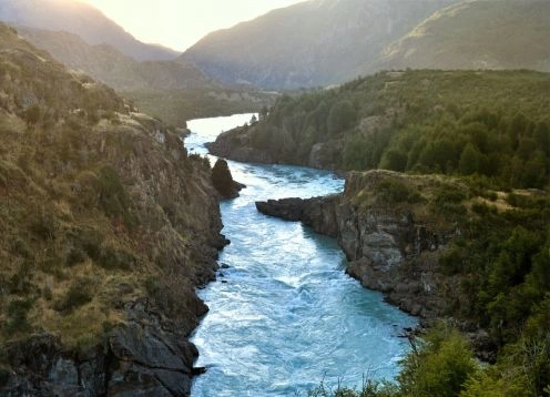
Caleta Tortel is located in the province of Capitán Prat, XI Region of Aisén of General Carlos Ibáñez del Campo, on one side of the mouth of the Baker River.
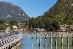
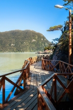
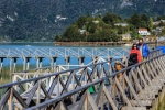
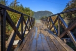
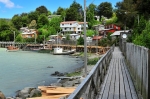
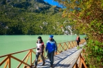
The year 2001 was declared a Typical Zone , the area formed by the 80-meter strip of the cove, the piers, the footbridges, the houses and the vegetation of the hill, including this one as a peninsula next to the delta of the Baker River.
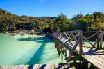
It has an area of ??20,390 km². It has a strategic location between the North and South Ice Fields (about 4,000 km² of communal glaciers). In it flow the largest river in Chile, the Baker River, also the Easter River, the Rio Grande (Chile) and the Huemules River, forming an estuarine basin and inland channels with an important contribution of fresh water of both glacial and pluvial. There is also the famous Gulf of Penas. Its rugged geography is divided into an archipelagic zone with an infinity of islands, channels and estuaries, and another, of steep mountain ranges crowned by glaciers, cut by narrow valleys.
This area was traveled from prehistoric times by Kawesqar canoe nomads, now practically extinct. The first European to sight this territory would have been Hernando de Magallanes in 1520, naming it "Tierras de Diciembre".
Based on the descriptions of P. Sarmiento de Gamboa (1579), B. Díaz Gallardo and A. de la Vea (1675-76) and the Jesuit J. García Alsué, who would be the first to arrive at the current Baker Canal, (which nominates "Mesier" and that occupies the "Calén Nation"), Juan de la Cruz Cano and Olmedilla made in 1775 the first map of the area in which the "Rio de los Cau Caos Bravos" flows as the drain of "Lake Chelenco" ( today Baker River and General Carrera Lake - Buenos Aires).
In 1798 the domain of the "Potrero de los Rabudos", between 43º and 48º South, was handed over to Juan Levién in payment of his services to Captain Moraleda, which was not made affective. Between 1826 to 1830 the King and Stokes Hydrographic Expedition raised part of the area and baptized in honor of its Admiral Baker Islands, located at the entrance of a channel that is insinuated.
The first Chilean recognition of the area occurred in 1888 when the Cdte. Adolfo Rodríguez, from the Chilean Navy, on board the "Toro" trap, explores the Calen or Baker fjord and discovers the Bravo and Pascua rivers. On the basis of this information, the Government of Chile grants the first concession of 300,000 hectares of fiscal land in the Baker to Julio Vicuña Subercaseaux, which was never carried out, expiring.
In 1901 a concession was granted to Juan Tornero and others, to introduce 1000 families of European settlers between the 42nd and 52nd, which was reformulated when the National Society of Livestock and Colonization, later called the Explotadora del Baker Company, was constituted in 1903, with the participation of Mauricio Braun H. and other powerful businessmen from Punta Arenas. This company would be the first to occupy the area with facilities in Puerto Bajo Pisagua, located on the north side of the mouth of the Baker, and houses, posts and paths upstream. In 1907 he also installed a sawmill and dock in what is now the Rincón de Caleta Tortel.